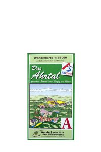
Bicycling & hiking map Bad Neuenahr-Ahrweiler and the Ahr Valley
1 : 25000
That Bad Neuenahr-Ahrweiler forms the centre of the bicycling and hiking map is shown on the map section, the city map and the illustrated infobar on the back side. The city lies in the Ahr Valley which is bordered on the south by the Eifel. Marked hiking and bicycling paths lead through the low mountain range and along the Ahr to the Rhine. Worth mentioning: The Red Wine Hiking Path which leads through the wine terraces near the river’s banks. Additional information can be found on the back side.
Territorial boundaries
North: Gelsdorf, Nierendorf, Remagen
East: Remagen, Sinzig, Niederzissen
South: Niederdürenbach, Oberzissen
West: Altenahr, Ahrbrück
With the city map for Bad Neuenahr-Ahrweiler and many recreational tips!
Weatherproof, tear-proof, wipeable
Published by the publicpress Publishing House